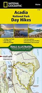
Reseña del libro "Acadia National Park day Hikes map (en Inglés)"
- Waterproof - Tear-Resistant - Topographic MapPreserving almost 50,000 acres of islands and peninsula along the jagged north-central coast of Maine, Acadia is home to more than two dozen mountains, including the highest point on the United States' Atlantic coast, Cadillac Mountain (1,530 feet). Acadia has 158 miles of scenic hiking trails, 45 miles of rustic carriage roads, and 33 miles of historic motor roads, all winding through an iconic geologic and ecologic landscape. Hikes range from relaxing walks exploring tidepools along rugged coastlines to steep climbs up iron rung ladders leading to expansive island views.The Acadia National Park Day Hikes Topographic Map Guide contains detailed maps for 18 of Acadia's finest day hikes. It includes well-known hikes and some off-the-beaten-path trails. They range from easy strolls to strenuous climbs, selected to give you a sampling of all the park has to offer. Together, they cover more than 60 miles of adventures. One-third of the selected hikes are less than 3 miles long, two-thirds are less than 5 miles, and one hike is 6 miles long.Each of the 18 maps include directions to the trailhead, the total distance to complete the hike, and an estimate of the degree of difficulty. Also provided are elevations of key points on the trail, an elevation profile for the hike, and a calculation of the hike's total elevation gain. Concise trail descriptions will help you find the hikes that best suit your interests, conditioning, and available time.Every Trails Illustrated map is printed on "Backcountry Tough" waterproof, tear-resistant paper. A full UTM grid is printed on the map to aid with GPS navigation. Every map purchase helps support the National Geographic Society, an impact driven, nonprofit organization with global reach that uses the power of science, exploration, education, and storytelling to illuminate and protect the wonder of our world.Map Scale = 1:31,680Folded Size = 4.25" x 9.38"