Este verano, una historia te está esperando  Ver más

Enviar a
Provincia de Madrid
0
  • argentina
  • chile
  • colombia
  • españa
  • méxico
  • perú
  • estados unidos
  • internacional

Selecciona tu país

América

Europa

Resto del mundo

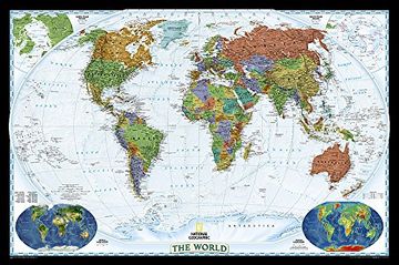
portada El Mundo Decorator (76X117) Pequeño Inglés: Wall Maps World (National Geographic Reference Map) (en Inglés)
Formato
Libro Físico
Año
2016
Idioma
Inglés
N° páginas
1
Encuadernación
Asignar
Dimensiones
94.6 x 7.9 x 7.9 cm
Peso
0.57 kg.
ISBN13
9780792280866
N° edición
2021

El Mundo Decorator (76X117) Pequeño Inglés: Wall Maps World (National Geographic Reference Map) (en Inglés)

National Geographic Maps (Autor) · National Geographic Maps · Asignar

El Mundo Decorator (76X117) Pequeño Inglés: Wall Maps World (National Geographic Reference Map) (en Inglés) - National Geographic Maps

Libro Nuevo Importado
Envío: 11 a 18 días háb.
28,64 €27,21 €
-5%
Libro Nuevo

Quedan 3 unidades

27,21 €
Llega entre el 28 Jul y el 10 Ago a Provincia de Madrid. Seleccionar ubicación

Reseña del libro "El Mundo Decorator (76X117) Pequeño Inglés: Wall Maps World (National Geographic Reference Map) (en Inglés)"

Expertly researched and designed, National Geographic's World Wall Map is the authoritative map of the world by which other reference maps are measured.Product Features: Colorful Decorator style map with vibrant color palette that fills each country for easy identificationBackground shows mountain ranges and valleys in subtle shaded relief with mountain ranges labeled Major water bodies including rivers, lakes, glaciers, oceans, seas, gulfs, bays, straits, and bathymetryClearly defined international boundaries, cities, islands, airports, and physical featuresThousands of place names carefully and artfully placed to maintain legibility in heavily populated areasUp-to-date international boundaries and territorial control reflect de facto status on the groundMeticulously researched using multiple authoritative sources including the U.N., U.S. Board on Geographic Names, and policies of individual governments.Accurate place names use a combination of conventional English names, official national names, and standard transliterations for non-Latin alphabets. Drawn in Winkel Tripel projection with distortions minimized unlike other World maps (e.g. Greenland is shown the same size as Argentina, not South America)Corner inset maps feature vegetation, land use, population density, and north and south polar regionsThe map is packaged in a two inch diameter tube with a label showing a thumbnail of the map with dimensions and other pertinent information.Map Scale = 1:29,802,000Sheet Size = 46" x 30.5"

Opiniones del libro

Preguntas frecuentes sobre el libro

Todos los libros de nuestro catálogo son Originales.
El libro está escrito en Inglés.
La encuadernación de esta edición es Asignar.

Preguntas y respuestas sobre el libro

¿Tienes una pregunta sobre el libro? Inicia sesión para poder agregar tu propia pregunta.

Opiniones sobre Buscalibre

Ver más opiniones de clientes