Compartir
Atlas Of The Transatlantic Slave Trade (the Lewis Walpole Series In Eighteenth-century Culture & History) (en Inglés)
David Eltis
(Autor)
·
David Richardson
(Autor)
·
David W. Blight
(Epílogo de)
·
Yale University Press
· Tapa Blanda
Atlas Of The Transatlantic Slave Trade (the Lewis Walpole Series In Eighteenth-century Culture & History) (en Inglés) - Eltis, David ; Richardson, David ; Blight, David W.
32,66 €
34,38 €
Ahorras: 1,72 €
Elige la lista en la que quieres agregar tu producto o crea una nueva lista
✓ Producto agregado correctamente a la lista de deseos.
Ir a Mis ListasSe enviará desde nuestra bodega entre el
Jueves 06 de Junio y el
Martes 11 de Junio.
Lo recibirás en cualquier lugar de España entre 1 y 5 días hábiles luego del envío.
Reseña del libro "Atlas Of The Transatlantic Slave Trade (the Lewis Walpole Series In Eighteenth-century Culture & History) (en Inglés)"
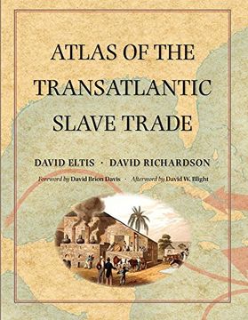
A extraordinary work, decades in the making: the first atlas to illustrate the entire scope of the transatlantic slave trade Winner of the Association of American Publishers' 2010 R.R. Hawkins Award and PROSE Award "A monumental chronicle of this historical tragedy."--Dwight Garner, New York Times Between 1501 and 1867, the transatlantic slave trade claimed an estimated 12.5 million Africans and involved almost every country with an Atlantic coastline. In this extraordinary book, two leading historians have created the first comprehensive, up-to-date atlas on this 350-year history of kidnapping and coercion. It features nearly 200 maps, especially created for the volume, that explore every detail of the African slave traffic to the New World. The atlas is based on an online database (www.slavevoyages.org) with records on nearly 35,000 slaving voyages--roughly 80 percent of all such voyages ever made. Using maps, David Eltis and David Richardson show which nations participated in the slave trade, where the ships involved were outfitted, where the captives boarded ship, and where they were landed in the Americas, as well as the experience of the transatlantic voyage and the geographic dimensions of the eventual abolition of the traffic. Accompanying the maps are illustrations and contemporary literary selections, including poems, letters, and diary entries, intended to enhance readers' understanding of the human story underlying the trade from its inception to its end. This groundbreaking work provides the fullest possible picture of the extent and inhumanity of one of the largest forced migrations in history.

