Compartir
Geomorphology and Bank Erosion of the Matanuska River, Southcentral Alaska (en Inglés)
Monica L. McTeague
(Autor)
·
Janet H. Curran
(Autor)
·
Createspace Independent Publishing Platform
· Tapa Blanda
Geomorphology and Bank Erosion of the Matanuska River, Southcentral Alaska (en Inglés) - McTeague, Monica L. ; Curran, Janet H.
26,50 €
27,89 €
Ahorras: 1,39 €
Elige la lista en la que quieres agregar tu producto o crea una nueva lista
✓ Producto agregado correctamente a la lista de deseos.
Ir a Mis Listas
Origen: Estados Unidos
(Costos de importación incluídos en el precio)
Se enviará desde nuestra bodega entre el
Miércoles 24 de Julio y el
Lunes 12 de Agosto.
Lo recibirás en cualquier lugar de España entre 1 y 5 días hábiles luego del envío.
Reseña del libro "Geomorphology and Bank Erosion of the Matanuska River, Southcentral Alaska (en Inglés)"
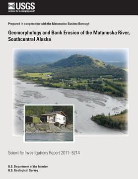
Bank erosion along the Matanuska River, a braided, glacial river in southcentral Alaska, has damaged or threatened houses, roadways, and public facilities for decades. Mapping of river geomorphology and bank characteristics for a 65-mile study area from the Matanuska Glacier to the river mouth provided erodibility information that was assessed along with 1949-2006 erosion to establish erosion hazard data. Braid plain margins were delineated from 1949, 1962, and 2006 orthophotographs to provide detailed measurements of erosion. Bank material and height and geomorphic features within the Matanuska River valley (primarily terraces and tributary fans) were mapped in a Geographic Information System (GIS) from orthophotographs and field observations to provide categories of erodibility and extent of the erodible corridor. The braid plain expanded 861 acres between 1949 and 2006. Erosion in the highest category ranged from 225 to 1,043 feet at reaches of bank an average of 0.5 mile long, affecting 8 percent of the banks but accounting for 64 percent of the erosion.
- 0% (0)
- 0% (0)
- 0% (0)
- 0% (0)
- 0% (0)
Todos los libros de nuestro catálogo son Originales.
El libro está escrito en Inglés.
La encuadernación de esta edición es Tapa Blanda.
✓ Producto agregado correctamente al carro, Ir a Pagar.

