Compartir
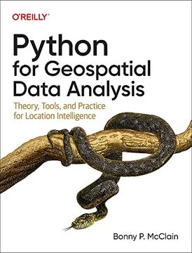
Python for Geospatial Data Analysis: Theory, Tools, and Practice for Location Intelligence (en Inglés)
Bonny McClain
(Autor)
·
O'Reilly Media
· Tapa Blanda
Python for Geospatial Data Analysis: Theory, Tools, and Practice for Location Intelligence (en Inglés) - McClain, Bonny
71,09 €
74,83 €
Ahorras: 3,74 €
Elige la lista en la que quieres agregar tu producto o crea una nueva lista
✓ Producto agregado correctamente a la lista de deseos.
Ir a Mis Listas
Origen: Reino Unido
(Costos de importación incluídos en el precio)
Se enviará desde nuestra bodega entre el
Martes 14 de Mayo y el
Viernes 24 de Mayo.
Lo recibirás en cualquier lugar de España entre 1 y 5 días hábiles luego del envío.
Reseña del libro "Python for Geospatial Data Analysis: Theory, Tools, and Practice for Location Intelligence (en Inglés)"
In spatial data science, things in closer proximity to one another likely have more in common than things that are farther apart. With this practical book, geospatial professionals, data scientists, business analysts, geographers, geologists, and others familiar with data analysis and visualization will learn the fundamentals of spatial data analysis to gain a deeper understanding of their data questions. Author Bonny P. McClain demonstrates why detecting and quantifying patterns in geospatial data is vital. Both proprietary and open source platforms allow you to process and visualize spatial information. This book is for people familiar with data analysis or visualization who are eager to explore geospatial integration with Python. This book helps you: Understand the importance of applying spatial relationships in data science Select and apply data layering of both raster and vector graphics Apply location data to leverage spatial analytics Design informative and accurate maps Automate geographic data with Python scripts Explore Python packages for additional functionality Work with atypical data types such as polygons, shape files, and projections Understand the graphical syntax of spatial data science to stimulate curiosity
- 0% (0)
- 0% (0)
- 0% (0)
- 0% (0)
- 0% (0)
Todos los libros de nuestro catálogo son Originales.
El libro está escrito en Inglés.
La encuadernación de esta edición es Tapa Blanda.
✓ Producto agregado correctamente al carro, Ir a Pagar.

