Compartir
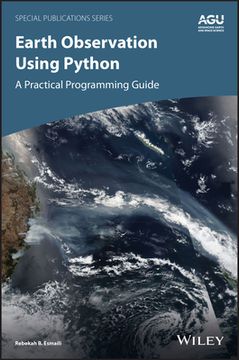
Python for Remote Sensing Applications in Earth Science: A Practical Programming Guide (Geophysical Monograph Series) (en Inglés)
Rebekah B. Esmaili
(Autor)
·
American Geophysical Union
· Tapa Dura
Python for Remote Sensing Applications in Earth Science: A Practical Programming Guide (Geophysical Monograph Series) (en Inglés) - Esmaili, Rebekah B.
211,36 €
222,48 €
Ahorras: 11,12 €
Elige la lista en la que quieres agregar tu producto o crea una nueva lista
✓ Producto agregado correctamente a la lista de deseos.
Ir a Mis Listas
Origen: Estados Unidos
(Costos de importación incluídos en el precio)
Se enviará desde nuestra bodega entre el
Jueves 06 de Junio y el
Martes 25 de Junio.
Lo recibirás en cualquier lugar de España entre 1 y 5 días hábiles luego del envío.
Reseña del libro "Python for Remote Sensing Applications in Earth Science: A Practical Programming Guide (Geophysical Monograph Series) (en Inglés)"
Learn basic Python programming to create functional and effective visualizations from earth observation satellite data sets Thousands of satellite datasets are freely available online, but scientists need the right tools to efficiently analyze data and share results. Python has easy-to-learn syntax and thousands of libraries to perform common Earth science programming tasks. Earth Observation Using Python: A Practical Programming Guide presents an example-driven collection of basic methods, applications, and visualizations to process satellite data sets for Earth science research. Gain Python fluency using real data and case studies Read and write common scientific data formats, like netCDF, HDF, and GRIB2 Create 3-dimensional maps of dust, fire, vegetation indices and more Learn to adjust satellite imagery resolution, apply quality control, and handle big files Develop useful workflows and learn to share code using version control Acquire skills using online interactive code available for all examples in the book The American Geophysical Union promotes discovery in Earth and space science for the benefit of humanity. Its publications disseminate scientific knowledge and provide resources for researchers, students, and professionals.Find out more about this book from this Q&A with the Author
- 0% (0)
- 0% (0)
- 0% (0)
- 0% (0)
- 0% (0)
Todos los libros de nuestro catálogo son Originales.
El libro está escrito en Inglés.
La encuadernación de esta edición es Tapa Dura.
✓ Producto agregado correctamente al carro, Ir a Pagar.

